What Is a Satellite?
A Complete Guide to the Machines Orbiting Our Planet

You might hear the word “satellite” every day — in weather forecasts, GPS directions, or news about SpaceX launches. But have you ever stopped to think: what actually is a satellite? What’s inside one? Why are there so many different kinds? Let’s dive in.
What Is a Satellite?
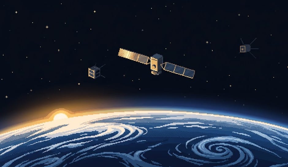
A satellite is any object that orbits another object due to gravity. The Moon is Earth’s natural satellite — it has been circling our planet for about 4.5 billion years. But when most people say “satellite,” they mean artificial satellites: human-made machines we deliberately launch into orbit to do useful work.
That work ranges from relaying TV signals and phone calls, to predicting hurricanes, to guiding your car’s GPS — and increasingly, to connecting remote sensors in places no cell tower can reach.
The First Satellite: Sputnik 1
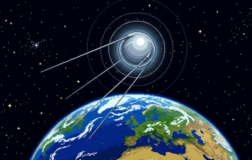
On October 4, 1957, the Soviet Union launched Sputnik 1 — the first artificial satellite in history. It was a polished metal sphere just 58 cm across, weighing 83.6 kg, with four whip antennas trailing behind it. It transmitted a simple radio beep.
That beep changed the world.
Sputnik completed one orbit every 96 minutes at altitudes between 215 and 939 km. It stayed in orbit for three months, then burned up re-entering the atmosphere in January 1958. Its only “payload” was a radio transmitter — but its political and scientific impact was enormous, triggering the Space Race between the US and USSR.
Just four months later, on January 31, 1958, the United States launched Explorer 1, its first satellite — and it immediately made a scientific discovery: the Van Allen radiation belts surrounding Earth.
A Brief History of Satellites
The evolution follows a clear arc: from one-off national prestige projects → scientific instruments → commercial infrastructure → today’s software-defined, rapidly-replaceable commercial spacecraft.
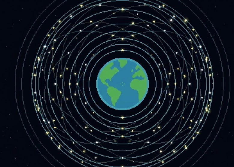
How Many Satellites Are Up There Right Now?
As of early 2026:
~10,000+ active satellites in orbit
~50,000+ tracked objects total (including rocket bodies and debris)
SpaceX Starlink alone: ~7,000+ satellites — one company now operates the majority of active spacecraft in history
Planet Labs: ~200+ Earth-imaging Doves — the largest Earth observation constellation
New satellites are being launched at a rate of hundreds per month
This is a dramatic inflection point. From 1957 to 2019 (~62 years), humanity launched roughly 8,000 objects total. In the 2020s alone, we’re on pace to launch that many again — in under a decade.
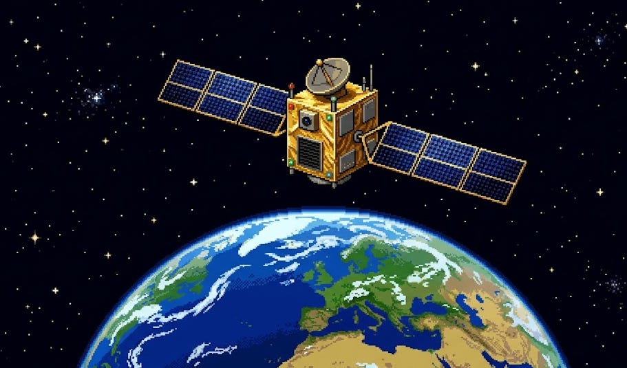
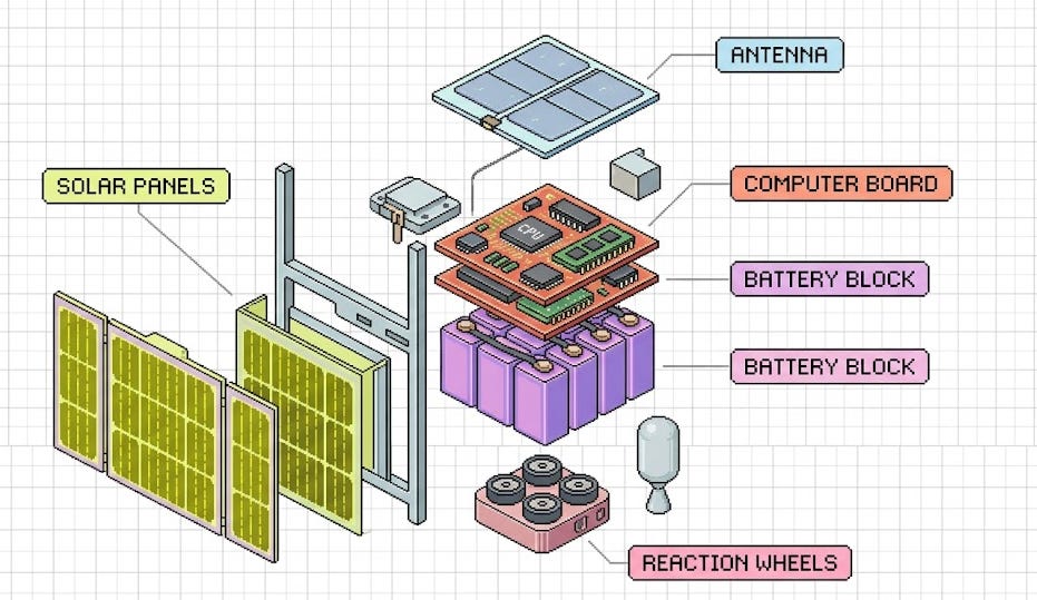
Key Systems Inside Every Satellite
No matter the size — from a 1U CubeSat to the Hubble — every satellite needs the same core subsystems to survive and operate in space.
1. Power (EPS — Electrical Power System)
The primary source is almost always solar panels (photovoltaic cells) that convert sunlight into electricity. Batteries store energy for when the satellite passes through Earth’s shadow. Some deep-space or nuclear-powered satellites use RTGs (Radioisotope Thermoelectric Generators) — like Voyager or Cassini.
2. Structure (Bus)
The physical frame holding everything together. Must survive launch vibrations (~20g), thermal cycling (from -150°C to +150°C every 90 minutes), and radiation. Usually aluminum, titanium, or composite.
3. Attitude Determination and Control (ADCS)
The system that points the satellite correctly. Uses a combination of:
Reaction wheels (spinning gyroscopes that rotate the satellite without fuel)
Magnetorquers (electromagnetic coils interacting with Earth’s magnetic field)
Thrusters (for larger corrections)
Star trackers, sun sensors, GPS (for knowing where you’re pointing)
4. Communications (Comms)
Radio antennas and transceivers for sending data to Earth (downlink) and receiving commands (uplink). Frequency bands vary: UHF/VHF for small sats, S/X/Ka-band for high-data-rate systems. Ground stations on Earth complete the link.
5. On-Board Computer (OBC)
The satellite’s “brain” — runs software, manages subsystems, processes commands, handles fault detection and autonomous recovery.
6. Thermal Control
Space has no air, so heat can’t convect — it only radiates. Satellites use passive thermal control (insulating blankets, gold foil, black paint) and sometimes active heaters or heat pipes to stay within operating temperature ranges.
7. Propulsion
Not all satellites have it. When present, options include:
Cold gas thrusters (simplest, low thrust)
Monopropellant / bipropellant chemical (medium thrust)
Ion / Hall-effect electric propulsion (very efficient, low thrust, ideal for LEO station-keeping and constellation management)
Plasma thrusters (emerging for CubeSats)
8. Payload
The actual mission instrument: a camera, a radio transponder, a scientific sensor, a GPS receiver, an AI processor — whatever the satellite was built to do. The bus exists to keep the payload alive and pointed correctly.
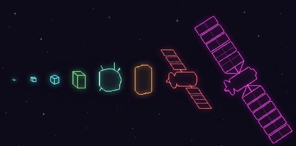
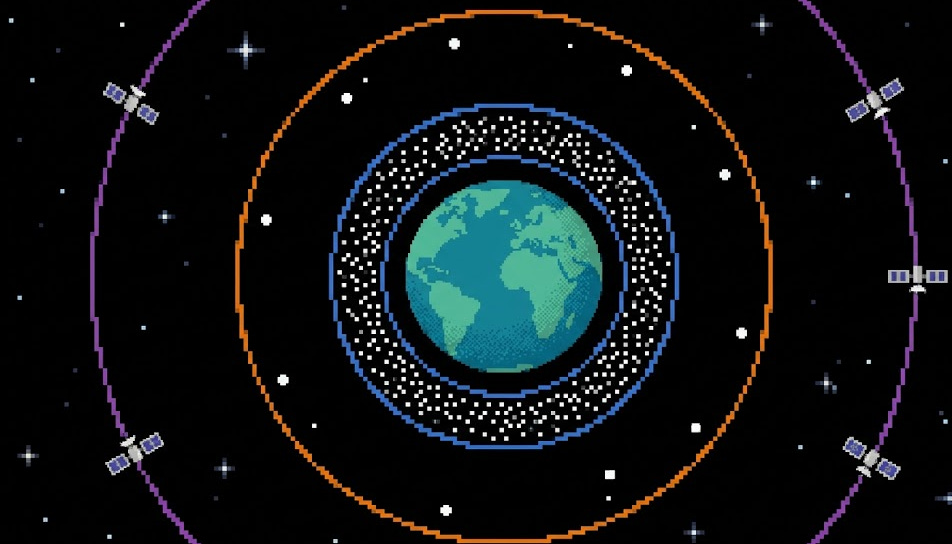
Types of Satellites by Size
One of the most exciting developments in the last 20 years is the miniaturization of satellites. What once required a school-bus-sized machine can now be done with something you can hold in your hand. Here’s the full spectrum:
FemtoSat (< 0.1 kg)
The smallest class. Experimental chips or wafer-scale satellites — some literally the size of a cracker. Still mostly research prototypes. Examples: KickSat Sprites (5g each, 3.5 × 3.5 cm). Capability is extremely limited but the concept is proving out — thousands could theoretically be deployed like a cloud.
PicoSat (0.1 – 1 kg) — including PocketQube
Slightly bigger. The PocketQube standard (5 cm × 5 cm × 5 cm cubes, labeled P: 1P, 2P, 3P) is the dominant picosat form factor. A 1P weighs roughly 100–200g. Useful for basic radio experiments, amateur astronomy, and technology demonstrations. Launch costs can be under $10K.
NanoSat (1 – 10 kg) — including CubeSat
The CubeSat revolution. The CubeSat standard (defined in 1999) uses a base unit of 1U = 10 × 10 × 10 cm (about 1 kg). Satellites come in 1U, 2U, 3U, 6U, 12U configurations. A 3U CubeSat (roughly the size of a large water bottle) can carry a useful camera, radio, or sensor.
CubeSats democratized space. Universities, startups, and national space agencies in developing countries can now afford to build and launch real spacecraft. Companies like Planet Labs built entire Earth-observation businesses on 3U “Dove” CubeSats.
Why CubeSats matter:
Standardized = cheaper to build, faster to design
Fits on rideshare launches with many others
3U launch cost: ~$30K–$100K depending on orbit
6-month to 2-year development cycles vs. 5–10 years for traditional satellites
MicroSat (10 – 100 kg)
Bigger than CubeSats but still small by traditional standards. Often custom form factors. Can carry higher-resolution cameras, more powerful radios, or specialized payloads. Companies like Spire Global, HawkEye 360, and early Planet SkySat satellites fall here. Typical launch cost: $500K–$2M.
MiniSat / SmallSat (100 – 500 kg)
The “small satellite” category as commonly used in industry refers to this range. Can carry serious imaging payloads, radar systems (SAR), or communication transponders. Planet SkySat, some OneWeb satellites, and many commercial Earth observation platforms live here.
Medium Satellite (500 kg – 1,000 kg)
Traditional workhorse class. GPS Block II satellites (~845 kg), many weather satellites, medium communication relay satellites.
Large / Heavy Satellite (1,000 kg+)
Traditional GEO communication satellites, military reconnaissance birds, and scientific spacecraft like Hubble (~11,000 kg) and the James Webb Space Telescope (~6,500 kg) live here. Cost: $300M–$1B+. Build time: 5–10 years. These are being replaced in many use cases by constellations of smaller satellites.
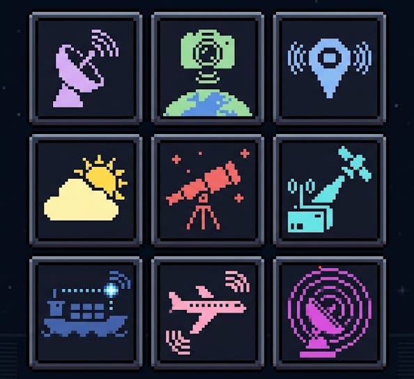
Types of Satellites by Purpose
Beyond size, satellites are classified by what they do:
Communication Satellites (ComSats)
Relay signals — TV, phone, internet, maritime/aviation communications. Two main orbits:
GEO (Geostationary, 35,786 km): Appears stationary above one point on Earth. Three satellites can cover the whole planet. High latency (~600ms round-trip). Traditional TV/telecom.
LEO constellations (500–1,200 km): Low latency (~20–40ms). Starlink, OneWeb, Amazon Kuiper. The new paradigm.
Earth Observation (EO) Satellites
Image Earth’s surface for agriculture, urban planning, military intelligence, disaster response, climate monitoring. Resolution has improved from 10-meter (Landsat in the 1970s) to 30-centimeter commercial imagery (Maxar today). Planet Labs images the entire Earth’s landmass every day with their Dove fleet.
Navigation / PNT Satellites
GPS (US), GLONASS (Russia), Galileo (EU), BeiDou (China), NavIC (India), QZSS (Japan). These constellations provide positioning, navigation, and timing signals that every smartphone, autonomous vehicle, aircraft, and ship depends on. Canada is the only G7 nation without a sovereign PNT system — an opening for new players.
Weather / Meteorological Satellites
GOES (US geostationary weather), NOAA POES (polar-orbiting), Meteosat (European) — these are the satellites behind every weather forecast you’ve ever seen. They measure cloud cover, sea surface temperature, atmospheric moisture, storm intensity.
Scientific / Research Satellites
Hubble, James Webb, Chandra (X-ray), Fermi (gamma-ray), GRACE (measuring Earth’s gravitational field), DSCOVR (solar weather). One-of-a-kind missions designed for pure science.
IoT / Machine-to-Machine (M2M) Satellites
The newest and fastest-growing category. Small LEO satellites specifically designed to collect tiny data packets from sensors in remote locations — mines, pipelines, ships, wildlife trackers, agricultural sensors. Myriota, Kineis, Astrocast, Lacuna Space — and new entrants like Player One Space — are building constellations specifically for this.
AIS / Maritime Domain Awareness
AIS (Automatic Identification System) transponders are mandatory on large ships. Space-based AIS receivers on LEO satellites collect ship position data globally, enabling maritime tracking even in the middle of the Pacific. exactEarth (acquired by Spire), Orbcomm, and Spire Global sell this data to coast guards, insurers, and logistics companies.
ADS-B / Aviation Surveillance
Similar to AIS but for aircraft. Ground-based ADS-B has coverage gaps over oceans. Aireon (on Iridium satellites) provides global aircraft tracking from space. Critical for oceanic flight management.
Military / Reconnaissance Satellites
Early-warning missile detection (DSP/SBIRS), signals intelligence (SIGINT), imagery intelligence (IMINT), and communications for military operations. Often classified. The most capable imaging satellites can reportedly resolve objects under 10 cm from 400+ km altitude.
Technology Demonstration Satellites
Small satellites launched specifically to test new technologies before committing them to an expensive operational mission. CubeSats are ideal for this — fail cheaply, iterate fast.
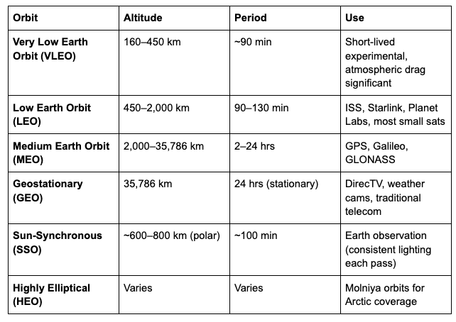
Orbits: Where Satellites Live
Orbit altitude determines what a satellite can do, how often it passes overhead, and how long signals take to travel.
The CubeSat Standard — A Closer Look
Because CubeSats represent such a paradigm shift, they deserve their own section.
The standard:
1U = 10 × 10 × 10 cm, ~1 kg
3U = 10 × 10 × 30 cm, ~3 kg (most common)
6U = 10 × 20 × 30 cm, ~6 kg (current commercial sweet spot)
12U = 20 × 20 × 30 cm, ~12 kg (large CubeSat)
27U = 30 × 30 × 30 cm, ~24 kg (emerging)
Why the standard matters: Standardization means off-the-shelf radios, batteries, solar panels, OBCs, ADCS modules, and deployers are all interoperable. You can buy a CubeSat kit like a PC — choose your components, integrate, test, launch. This dropped development costs from $100M+ (traditional satellite) to $50K–$500K (6U CubeSat).
Real-world CubeSat examples:
GOES-16 Compact Comms Demo — 6U, NASA
Planet Labs Dove — 3U, commercial Earth imaging
Spire LEMUR-2 — 3U, weather/AIS/ADS-B
LightSail 2 — 3U, solar sail propulsion demo
CAPSTONE — 12U, lunar pathfinder for the Gateway station
The Future: What Comes Next
The satellite industry is in the middle of a transformation that looks a lot like what happened to computing in the 1980s — from mainframes to PCs.
Key trends:
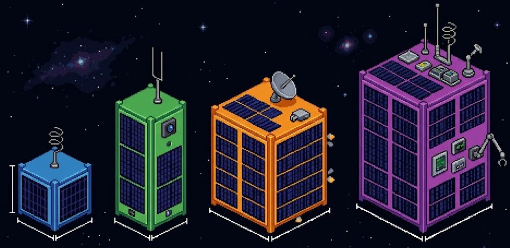
Megaconstellations — Starlink, OneWeb, Amazon Kuiper, and China’s SatNet are deploying thousands of satellites to provide global broadband. By 2030, there could be 100,000+ active satellites.
Software-defined satellites — Satellites that can be reprogrammed in orbit to change their mission, frequency bands, or beam patterns. The satellite becomes a flexible radio/compute platform, not a fixed instrument.
On-orbit AI — Processing data on the satellite before downlinking (edge AI). Dramatically reduces the data volume that needs to be transmitted. Instead of sending raw imagery, send “I found a wildfire at these coordinates.”
Satellite IoT — The next frontier of connectivity. LEO satellites specifically designed to collect micro-data from billions of sensors in places no cellular network reaches. Growing at high-teens CAGR.
In-orbit servicing — Robots that can refuel, repair, or upgrade satellites in orbit. Northrop Grumman’s MEV-1 has already successfully docked with and extended the life of an aging GEO satellite.
Debris management — With ~50,000+ tracked objects, orbital debris is a real problem. Active debris removal, better deorbit systems on new satellites, and international regulations are all developing rapidly.
Summary
Satellites went from a 58cm metal sphere beeping over the Soviet Union in 1957 to 10,000+ active machines orbiting Earth today, doing everything from guiding your phone’s GPS to imaging every acre of farmland daily to connecting sensors in Arctic shipping lanes.
The key insight: satellites are no longer special. A university team can build and launch one. A startup can operate a constellation. A remote sensor in the Sahara or on the deck of a ship 2,000 km from the nearest coast can now transmit data reliably, affordably, and regularly.
We are in the early innings of a world where everything connected to the internet isn’t connected via a tower on the ground — but via a satellite overhead.